A history of the Dust Trail on the former Fort Ord
Compiled by Fred Watson, PhD
Copyright (C) F. Watson. Last updated: 8 Jan 2022.
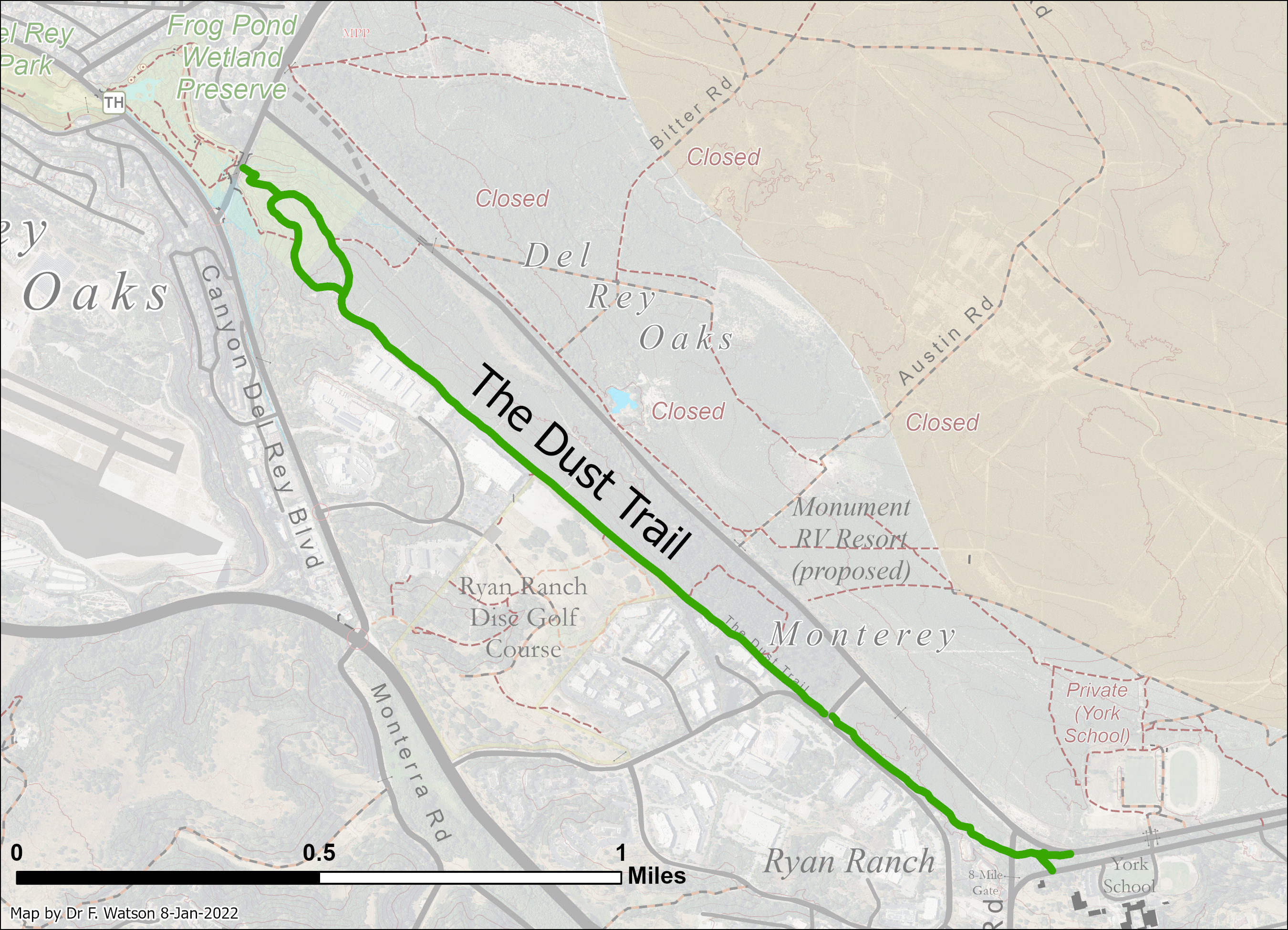
The Dust Trail is an approximately 1.75 mile long foot trail that runs between Frog Pond Wetland Preserve and York School along the Army side of the fence line that formerly indicated the perimeter of the Fort Ord military base.
It was built in around 1960 and has been continuously used ever since. Recreational use dates at least back to when Fort Ord was closed, and possibly earlier, judging by aerial photographs and county planning documents from 1971 and 1984.
The land through which the trail runs is mostly owned by the City of Monterey, with portions owned by the City of Del Rey Oaks and the Monterey Peninsula Regional Park District.
The name "Dust Trail" probably originated at York School. The trail is extensively used by the York athletic teams for running training, as well as for hiking and other activities. It is the "gateway to nearly every run" the cross-country team does - a "linchpin" of the highly successful team's program. (pers. comm. by principal Chuck Harmon in 2017 and again in 2022 by athletics coaches Steve Peters and Dr Jeff Hanna.)
The trail is a favorite of many members of the general public. It offers unique views and up-close experiences with maritime chaparral and a charming pine forest. Underfoot the terrain is mostly flat underlain by a firm but soft dust that gives the trail its name. Some variety is provided by some short steep rock sections in a few spots.
There are several ways to access the trail. Users can embark on a Dustr Trail hike or jog from locations such as Frog Pond, South Boundary Road near York School, Ryan Ranch Disc Golf Course, or the Ryan Ranch Business Park area.
Timeline:
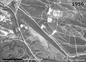
- 1956. The Dust Trail did not yet exist. The area was part of Fort Ord and covered with relatively undisturbed maritime chaparral vegetation.
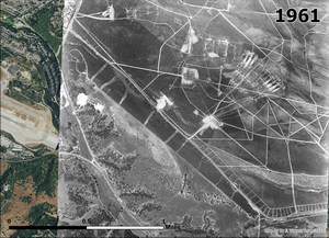
- 1961. The Dust Trail had been created - apparently by bulldozing a 12 ft wide jeep tral along the Army side of the perimeter fence.
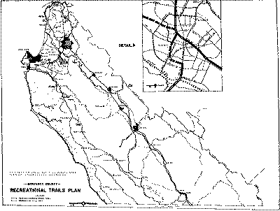
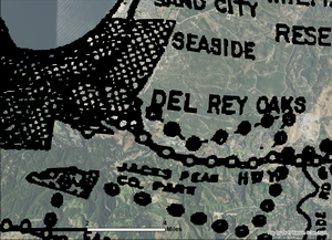
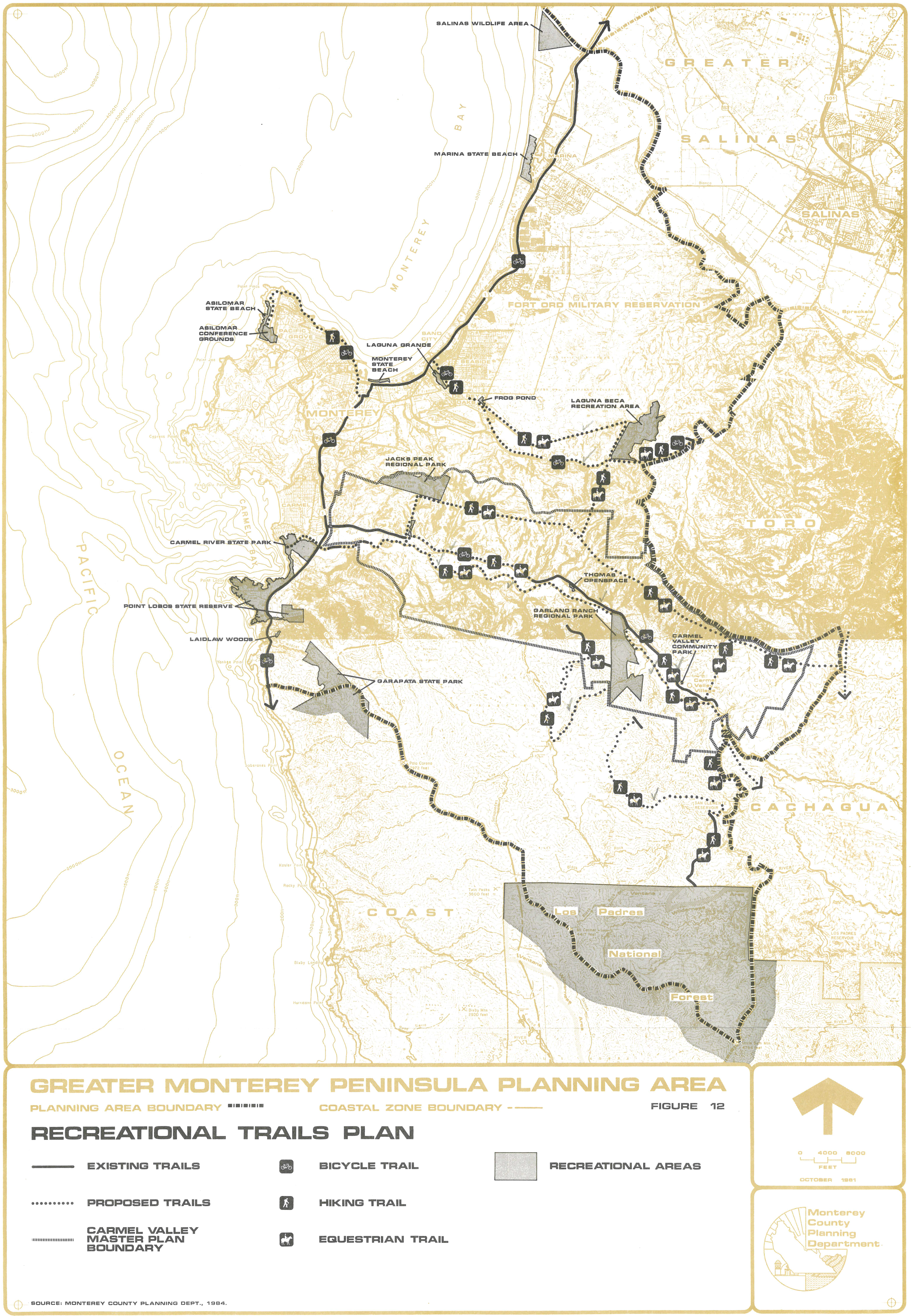
- 1971, March 30. "Monterey County Recreational Trails Plan" adopted by Monterey County Board of Supervisors. Includes a map showing a "Proposed Riding and Hiking Trail" traversing east-west in the location of the Dust Trail.
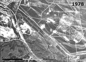
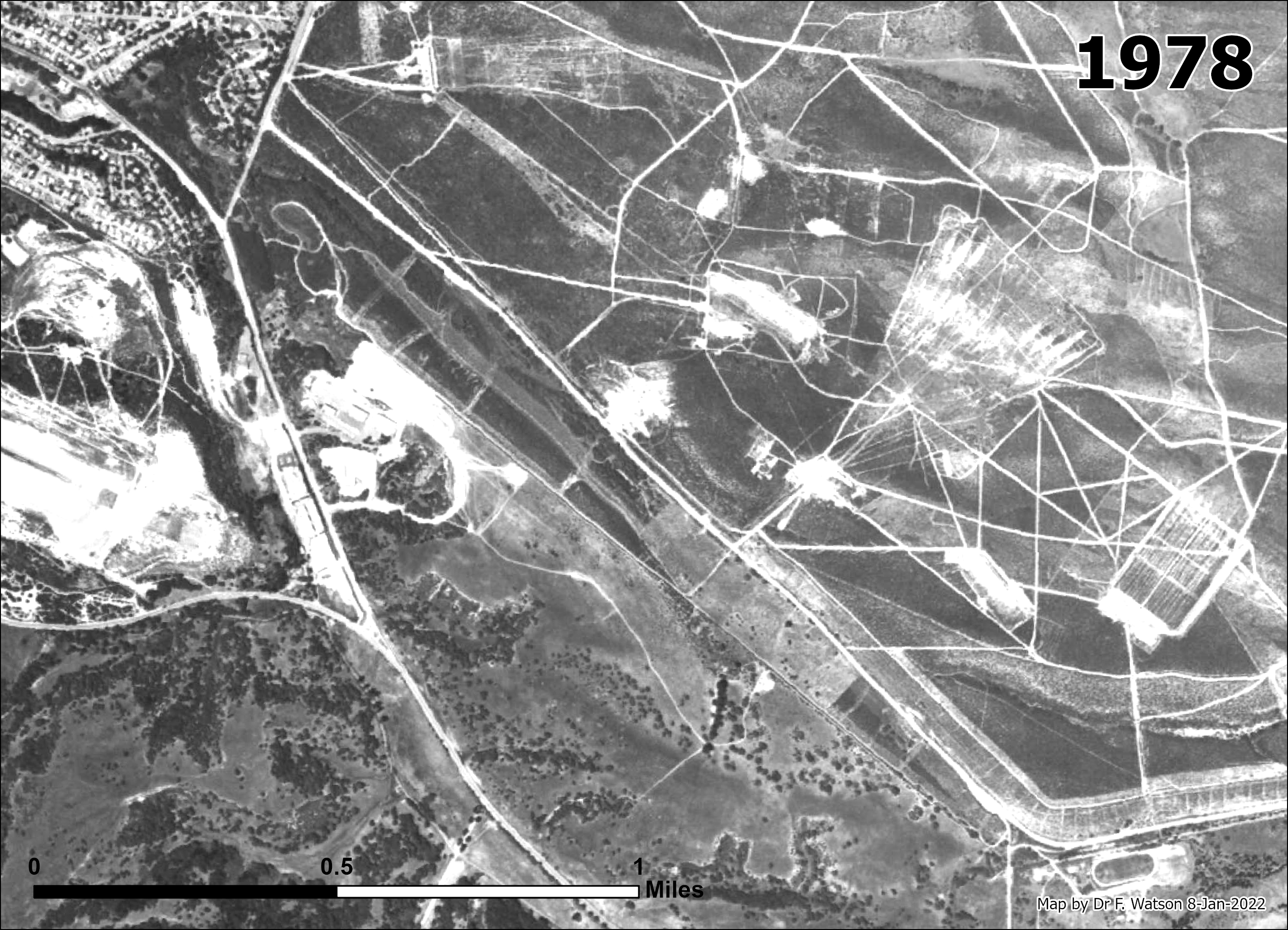
- 1978. The Dust Trail was a well-worn jeep trail.
The old athletics track existed at York School.
The "Pine Woods" along the Dust Trail did not exist yet, but the area where they stand now was apparently cleared of shrubs. By 1987, the Pine Woods were clearly visible in aerial imagery. David Styer once mentioned to me that he thought re called Jack Massera of BLM saying that he helped the Boy Scouts plant the pine woods.
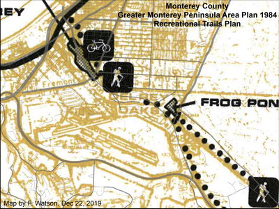
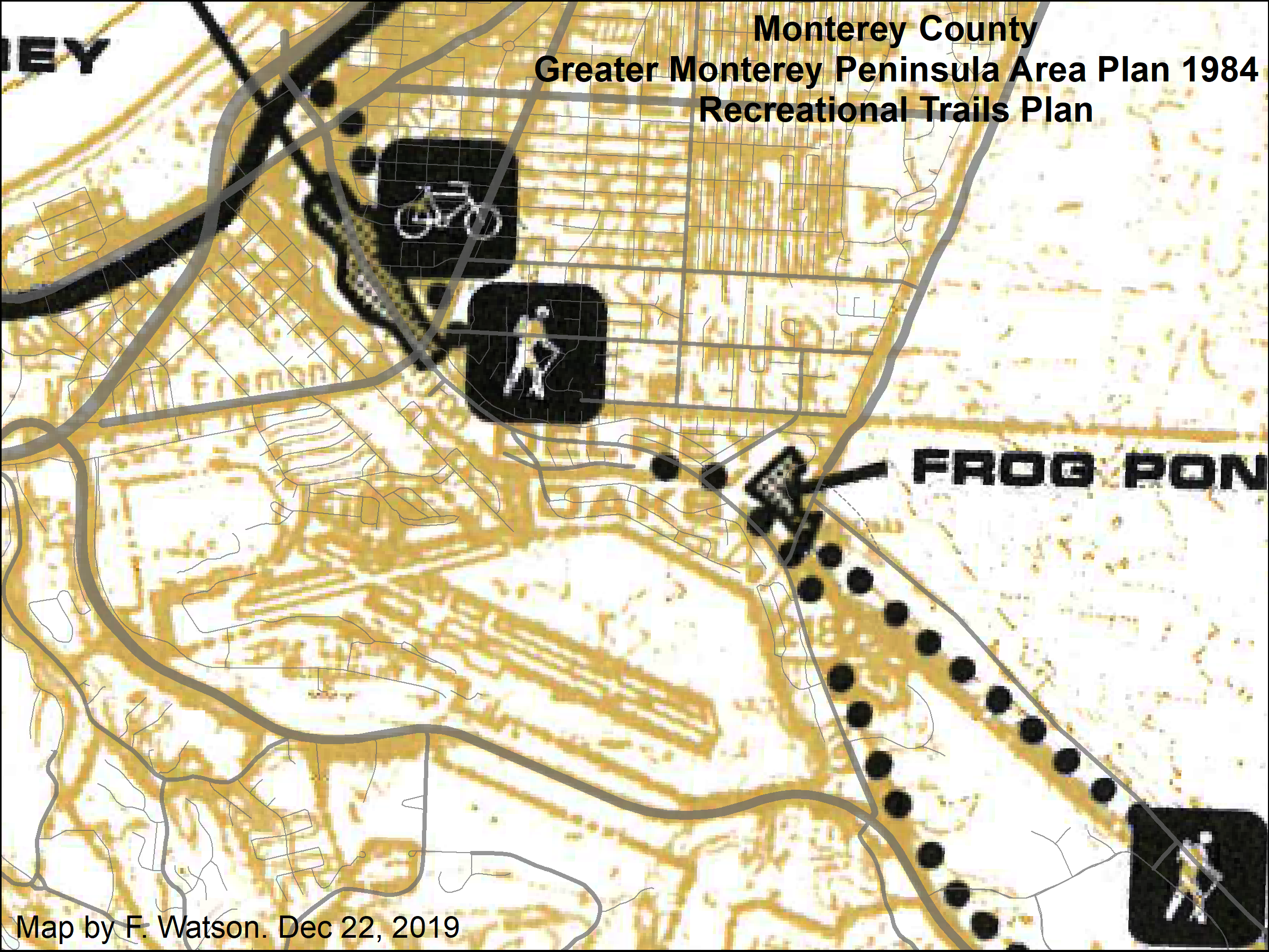
- 1984, Dec. 17. Greater Monterey Peninsula Area Plan adopted by Monterey County Board of Supervisors. Includes Recreational Trails Plan showing a hiking and equestrian trail corresponding to the Dust Trail.
- 1992, Jan. "Fort Ord Parklands - A Vision Statement" produced by the "Parklands Group" of 11 non-profit and related organizations including CNPS. Calls for the former Fort Ord areas along side SBR and GJMB to be maintained as a "greenbelt" of "Recreation Lands" providing a "wide range of recreational opportunities to the local community" including a "network of trails" running east-west generally parallel to SBR and north-south generally parallel to what was then North-South Road.
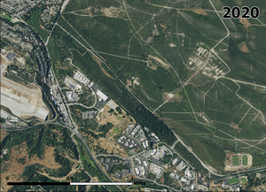
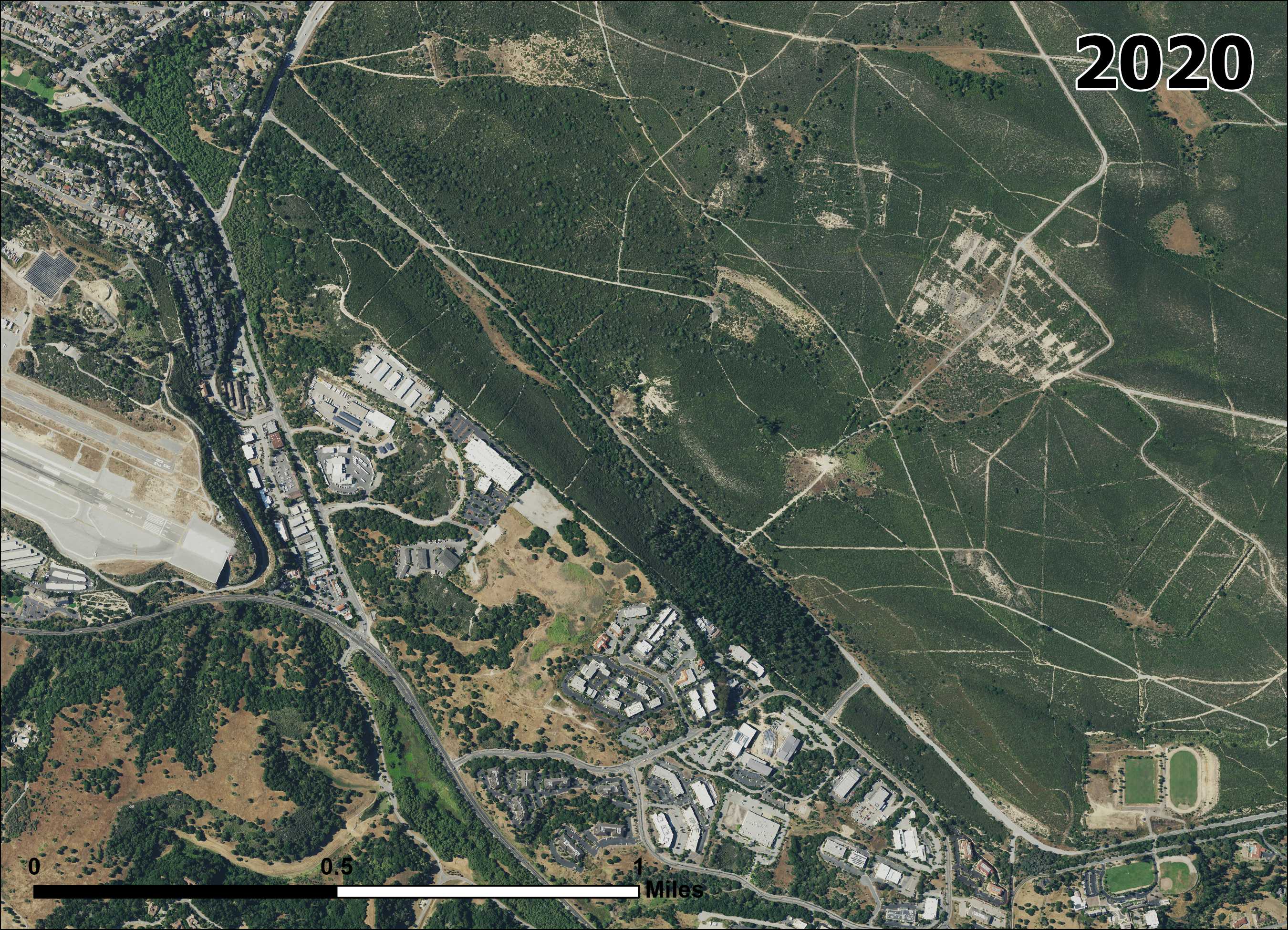
- 2020. The Dust Trail remains a well worn foot trail running continuously betwen the Frog Pond to York School